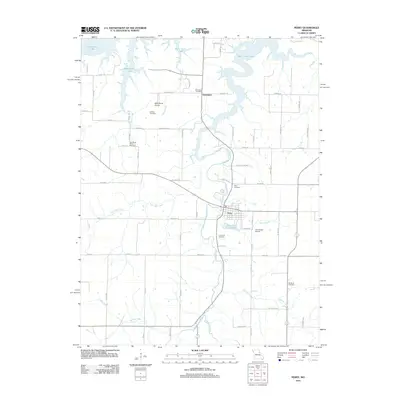
2012 Map of Perry
USGS Topo · Published 2012About this map
Perry serves as a central hub in Ralls County, surrounded by a complex network of waterways feeding into the southern reaches of Mark Twain Lake. The landscape is defined by the winding paths of Lick Creek and its many tributaries, including West Lick Creek, East Lick Creek, and Mace Branch. Smaller settlements and community centers like Greenlawn are connected by a grid of named rural routes such as Madison Trl and Greenlawn Trl.
Find a feature on this map
71 named features on this map. Tap any name to fly to it.
Don’t see what you’re looking for? This feature index may not catch every label — zoom into the map to look around manually.
Map Details
Editions of this 2012 Perry Map
This is the sole edition of this map. No revisions or reprints were ever made.
Other maps of this area

1890 · Mexico
USGS Topo · 1:125,000

1903 · Palmyra
USGS Topo · 1:125,000

1945 · Florida
USGS Topo · 1:62,500

1945 · Perry
USGS Topo · 1:62,500

1948 · Quincy
USGS Topo · 1:250,000

1956 · Quincy
USGS Topo · 1:250,000

1959 · Joanna
USGS Topo · 1:24,000
1959 · Center
USGS Topo · 1:24,000
1960 · Stoutsville
USGS Topo · 1:24,000
1972 · Santa Fe
USGS Topo · 1:24,000