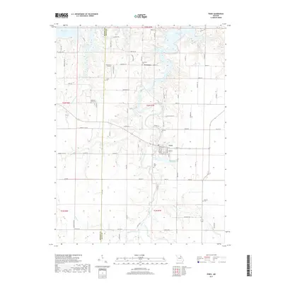
2017 Map of Perry
USGS Topo · Published 2017About this map
The city of Perry serves as the primary hub in this southwest corner of Ralls County, where the landscape is defined by the transition from agricultural plateaus to the intricate shoreline of Mark Twain Lake. The northern reaches of the map are dominated by the multi-lobed reservoir, which has transformed the valleys of Pigeon Roost Cr and Ely Br into expansive aquatic recreation areas. This 2017 survey details a region where modern infrastructure, like the Wood-Acres Airport, coexists with long-established rural foundations. Numerous burial grounds, including the Old Mount Prairie Cem and Scobee Cem, are scattered across the township lines of t54n r8w and t54n r7w, anchoring the genealogy of the area to its 19th-century pioneers. The drainage network remains vital to the local geography, with Lick Creek and its various branches like West Lick Creek and East Lick Creek carving through the terrain south of the main settlement.
Find a feature on this map
96 named features on this map. Tap any name to fly to it.
Don’t see what you’re looking for? This feature index may not catch every label — zoom into the map to look around manually.
Map Details
Editions of this 2017 Perry Map
This is the sole edition of this map. No revisions or reprints were ever made.
Other maps of this area

1890 · Mexico
USGS Topo · 1:125,000

1903 · Palmyra
USGS Topo · 1:125,000

1945 · Florida
USGS Topo · 1:62,500

1945 · Perry
USGS Topo · 1:62,500

1948 · Quincy
USGS Topo · 1:250,000

1956 · Quincy
USGS Topo · 1:250,000

1959 · Joanna
USGS Topo · 1:24,000
1959 · Center
USGS Topo · 1:24,000
1960 · Stoutsville
USGS Topo · 1:24,000
1972 · Santa Fe
USGS Topo · 1:24,000