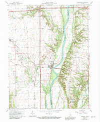
1964 Map of Perrysville
USGS Topo · Published 1992About this map
Perrysville sits on the western bank of the Wabash River in this mid-century survey of the Indiana-Illinois borderlands. The landscape transitions from the river bottomlands into the agricultural uplands of Highland and Troy townships. Rural life is anchored by small crossroads and community centers such as Gessie and Flat Iron, with numerous local landmarks providing genealogical value, including Hopewell Ch and the Lower Mound Cem.
Find a feature on this map
31 named features on this map. Tap any name to fly to it.
Don’t see what you’re looking for? This feature index may not catch every label — zoom into the map to look around manually.
Map Details
Editions of this 1964 Perrysville Map
3 editions found
Other maps of this area

1899 · Danville
USGS Topo · 1:62,500

1900 · Danville
USGS Topo · 1:62,500

1947 · Ridge Farm
USGS Topo · 1:62,500

1950 · Danville SE
USGS Topo · 1:24,000

1950 · Danville NE
USGS Topo · 1:24,000

1951 · Danville NE
USGS Topo · 1:24,000

1951 · Danville SE
USGS Topo · 1:24,000

1953 · Danville
USGS Topo · 1:250,000

1953 · Indianapolis
USGS Topo · 1:250,000

1955 · Danville
USGS Topo · 1:250,000