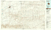
1986 Map of Perryton
USGS Topo · Published 1986About this map
Wolf Creek carves a deep, winding path through the center of this Panhandle landscape, creating a distinct topographical break from the surrounding plains. The 1980s economy of the region is clearly defined by extensive oil and gas fields and the prominent line of the Atchison Topeka and Santa Fe railroad, which links the northern grain and trade centers of Perryton, Booker, and Darrouzett. Settlement is clustered along this rail corridor and major highways like Route 15 and 83.
Find a feature on this map
82 named features on this map. Tap any name to fly to it.
Don’t see what you’re looking for? This feature index may not catch every label — zoom into the map to look around manually.
Map Details
Editions of this 1986 Perryton Map
This is the sole edition of this map. No revisions or reprints were ever made.
Other maps of this area

1954 · Perryton
USGS Topo · 1:250,000

1954 · Amarillo
USGS Topo · 1:250,000

1955 · Clinton
USGS Topo · 1:250,000

1955 · Woodward
USGS Topo · 1:250,000

1957 · Clinton
USGS Topo · 1:250,000

1958 · Perryton
USGS Topo · 1:250,000

1958 · Woodward
USGS Topo · 1:250,000

1958 · Amarillo
USGS Topo · 1:250,000

1966 · Antelope Hills
USGS Topo · 1:24,000

1968 · Hardesty SE
USGS Topo · 1:24,000