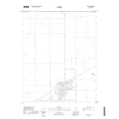
2019 Map of Perryton
USGS Topo · Published 2019About this map
The High Plains city of Perryton serves as the focal point of this Panhandle survey, situated in the northernmost reaches of Ochiltree County just below the Oklahoma border. The map illustrates a highly organized agricultural landscape defined by a rigid grid of county roads, such as Co Rd B and Co Rd 18, which partition the surrounding farmland. The urban center exhibits a dense network of local streets, including NW 1st Ave and SW 9th Ave, encircled by a transportation ring consisting of W Loop 143 and E Loop Rd. To the east, the Perryton Ochiltree County Airport provides an essential connection for this hub of the Texas Panhandle, while secondary routes like FM 1267 and Ranch Rd 377 facilitate movement through the vast sections of open country.
Find a feature on this map
74 named features on this map. Tap any name to fly to it.
Don’t see what you’re looking for? This feature index may not catch every label — zoom into the map to look around manually.
Map Details
Editions of this 2019 Perryton Map
This is the sole edition of this map. No revisions or reprints were ever made.
Other maps of this area

1954 · Perryton
USGS Topo · 1:250,000

1958 · Perryton
USGS Topo · 1:250,000

1973 · Farnsworth
USGS Topo · 1:24,000

1973 · Booker SW
USGS Topo · 1:24,000

1973 · Perryton SE
USGS Topo · 1:24,000

1973 · Perryton
USGS Topo · 1:24,000

1973 · Bryans Corner SW
USGS Topo · 1:24,000

1973 · Bryans Corner
USGS Topo · 1:24,000

1973 · Balko SW
USGS Topo · 1:24,000

1973 · Huntoon
USGS Topo · 1:24,000