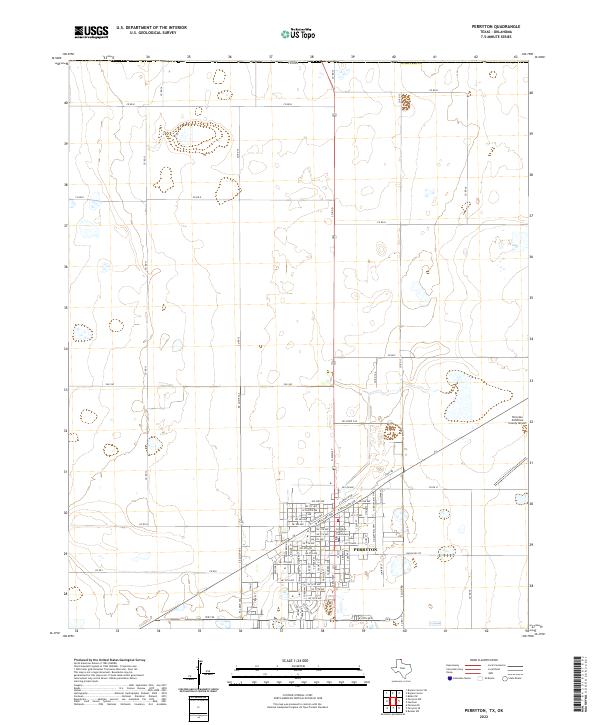
2022 Map of Perryton
USGS Topo · Published 2022About this map
Perryton, the seat of Ochiltree Co, serves as the primary urban center for this High Plains landscape. The town's grid is anchored by the Ochiltree County Courthouse and radiates outward with residential avenues such as NE 6th Ave and E Santa Fe Ave. The map illustrates a well-defined transportation infrastructure necessary for an agricultural and aviation hub, including N Industrial Hwy and the Perryton Ochiltree County Airport to the east. Outside the city limits, the terrain is partitioned by an extensive network of rural routes like Co Rd D and Co Rd 13, which connect scattered homesteads and farming operations. The sharp contrast between the concentrated city blocks and the surrounding open territory of the Texas Panhandle highlights the importance of this regional crossroads.
Find a feature on this map
66 named features on this map. Tap any name to fly to it.
Don’t see what you’re looking for? This feature index may not catch every label — zoom into the map to look around manually.
Map Details
Editions of this 2022 Perryton Map
This is the sole edition of this map. No revisions or reprints were ever made.
Other maps of this area

1954 · Perryton
USGS Topo · 1:250,000

1958 · Perryton
USGS Topo · 1:250,000

1973 · Farnsworth
USGS Topo · 1:24,000

1973 · Booker SW
USGS Topo · 1:24,000

1973 · Perryton SE
USGS Topo · 1:24,000

1973 · Perryton
USGS Topo · 1:24,000

1973 · Bryans Corner SW
USGS Topo · 1:24,000

1973 · Bryans Corner
USGS Topo · 1:24,000

1973 · Balko SW
USGS Topo · 1:24,000

1973 · Huntoon
USGS Topo · 1:24,000