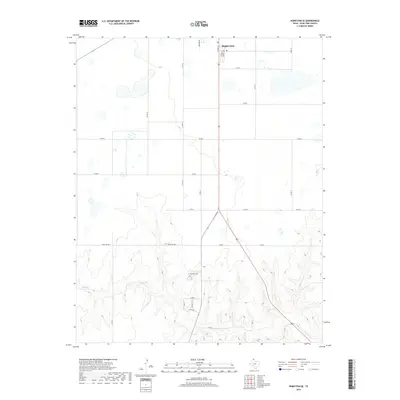
2019 Map of Perryton SE
USGS Topo · Published 2019About this map
Perryton sits at the northern edge of this Ochiltree County landscape, where the flat Panhandle plains begin their descent into the dissected break country. The southern portion of the map is defined by the winding course of Wolf Cr, which creates a network of sharp draws and ridges that contrast with the gridded agricultural land to the north. This transition from tableland to drainage basin is marked by a shift from rigid county roads to winding routes like Ranch Rd 3045.
Find a feature on this map
24 named features on this map. Tap any name to fly to it.
Don’t see what you’re looking for? This feature index may not catch every label — zoom into the map to look around manually.
Map Details
Editions of this 2019 Perryton SE Map
This is the sole edition of this map. No revisions or reprints were ever made.
Other maps of this area

1954 · Perryton
USGS Topo · 1:250,000

1958 · Perryton
USGS Topo · 1:250,000

1973 · Farnsworth
USGS Topo · 1:24,000

1973 · Booker SW
USGS Topo · 1:24,000

1973 · Sourdough Creek NE
USGS Topo · 1:24,000

1973 · Perryton SE
USGS Topo · 1:24,000

1973 · Perryton
USGS Topo · 1:24,000

1973 · Lake Fryer
USGS Topo · 1:24,000

1973 · Sourdough Creek NW
USGS Topo · 1:24,000

1973 · Huntoon
USGS Topo · 1:24,000