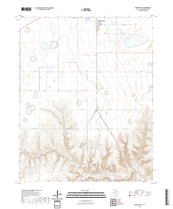
2022 Map of Perryton SE
USGS Topo · Published 2022About this map
Ochiltree Cem sits at the head of a complex drainage system just south of the developing outskirts of Perryton. This portion of Ochiltree County demonstrates the transition from the high, flat plains of the Panhandle into the deeply etched breaks formed by Wolf Cr and its many unnamed tributaries. The northern section of the map shows a structured grid of county roads, such as Co Rd 15 and Co Rd M, which give way to more winding routes like Ranch Rd 3045 as the elevation drops toward the creek beds. The southern reaches of the city are visible along S Main St, where a local Po and neighborhoods like Garrett Dr represent the modern expansion of this regional hub. The map serves as an important record of the environmental contrast between industrial-scale agriculture on the flats and the natural erosion patterns of the Texas breaks.
Find a feature on this map
26 named features on this map. Tap any name to fly to it.
Don’t see what you’re looking for? This feature index may not catch every label — zoom into the map to look around manually.
Map Details
Editions of this 2022 Perryton SE Map
This is the sole edition of this map. No revisions or reprints were ever made.
Other maps of this area

1954 · Perryton
USGS Topo · 1:250,000

1958 · Perryton
USGS Topo · 1:250,000

1973 · Farnsworth
USGS Topo · 1:24,000

1973 · Booker SW
USGS Topo · 1:24,000

1973 · Sourdough Creek NE
USGS Topo · 1:24,000

1973 · Perryton SE
USGS Topo · 1:24,000

1973 · Perryton
USGS Topo · 1:24,000

1973 · Lake Fryer
USGS Topo · 1:24,000

1973 · Sourdough Creek NW
USGS Topo · 1:24,000

1973 · Huntoon
USGS Topo · 1:24,000