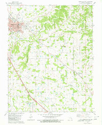
1980 Map of Perryville East
USGS Topo · Published 1980About this map
Perryville anchors the western edge of this 1980 survey, where the seat of Perry County is shown at a point of significant transition. The map captures the city's residential and educational infrastructure, including St Vincents High Sch and the central Courthouse, while also documenting the outlying rural character of the Missouri landscape. To the east and south, the terrain is defined by complex drainage systems like Cinque Hommes Creek and the winding Bedwell Hollow. Small, established communities such as Longtown and Friedenberg are linked by a network of rural roads, each containing its own focal points like York Chapel and Zion Cem. The prevalence of small family and church burial grounds, from Home Cem to the uniquely named Baptist Shed Cem, makes this an essential record for genealogical research in the Central Salem area during the late twentieth century.
Find a feature on this map
38 named features on this map. Tap any name to fly to it.
Don’t see what you’re looking for? This feature index may not catch every label — zoom into the map to look around manually.
Map Details
Editions of this 1980 Perryville East Map
2 editions found
Other maps of this area

1915 · Chester
USGS Topo · 1:62,500

1916 · Campbell Hill
USGS Topo · 1:62,500

1918 · Altenburg
USGS Topo · 1:62,500

1918 · Campbell Hill
USGS Topo · 1:62,500

1923 · Perryville
USGS Topo · 1:62,500

1924 · Perryville
USGS Topo · 1:62,500

1925 · Altenburg
USGS Topo · 1:62,500

1947 · Chester
USGS Topo · 1:62,500

1947 · Crosstown
USGS Topo · 1:24,000

1947 · Oak Ridge
USGS Topo · 1:24,000