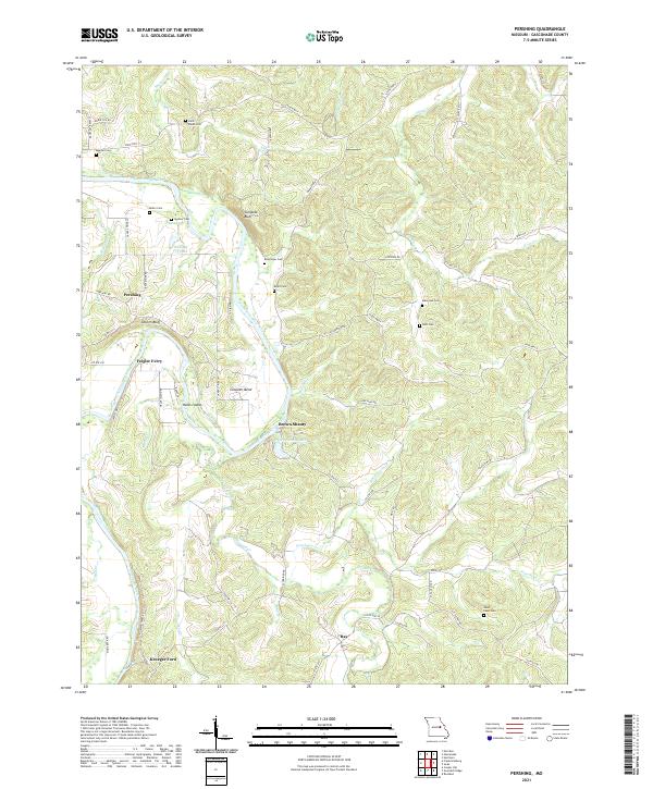
2021 Map of Pershing
USGS Topo · Published 2021About this map
The Gasconade River winds through this portion of Missouri, carving a deep valley defined by dramatic features like Turnpike Bluff, Church Bluff, and the wide curve of Clausner Bend. The landscape is a mix of river bottomlands and high ridges, with small settlements such as Pershing and Bay serving as local anchors. Numerous family cemeteries, including Spohrer Cem, Brant Cem, and Bohl Cem, are scattered across the uplands, providing essential records for genealogical research in Gasconade County.
Find a feature on this map
64 named features on this map. Tap any name to fly to it.
Don’t see what you’re looking for? This feature index may not catch every label — zoom into the map to look around manually.
Map Details
Editions of this 2021 Pershing Map
This is the sole edition of this map. No revisions or reprints were ever made.
Other maps of this area

1890 · Hermann
USGS Topo · 1:125,000

1890 · Fulton
USGS Topo · 1:125,000

1903 · Sullivan
USGS Topo · 1:125,000

1934 · Bland
USGS Topo · 1:62,500

1935 · Gerald
USGS Topo · 1:48,000

1935 · Morrison
USGS Topo · 1:48,000

1936 · Hermann
USGS Topo · 1:48,000

1937 · Bland
USGS Topo · 1:62,500

1941 · Gerald
USGS Topo · 1:62,500

1942 · Morrison
USGS Topo · 1:62,500