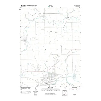
2010 Map of Peru
USGS Topo · Published 2010About this map
The Wabash River and Mississinewa River converge at Peru, a regional hub defined by its grid layout and riverfront geography. This survey documents the north-central Indiana landscape as it appeared in the early 21st century, showing the transition from the dense street patterns of Ridgeview and Oakdale to the rural expanses of northern Miami County. To the north, the Eel River meanders through the settlements of Mexico, Denver, and Chili. The distribution of burial sites, such as Mount Hope Cemetery and Westlawn Cemetery, provides significant data for genealogical research. Aviation infrastructure is noted with Rush Strip Airport and Benner Field, while drainage features like Prairie Ditch reflect the managed agricultural hydrology of the region.
Find a feature on this map
63 named features on this map. Tap any name to fly to it.
Don’t see what you’re looking for? This feature index may not catch every label — zoom into the map to look around manually.
Map Details
Editions of this 2010 Peru Map
This is the sole edition of this map. No revisions or reprints were ever made.
Other maps of this area

1951 · Peru
USGS Topo · 1:24,000

1951 · Onward
USGS Topo · 1:24,000

1951 · Twelve Mile
USGS Topo · 1:24,000

1951 · Bunker Hill
USGS Topo · 1:24,000

1951 · Richvalley
USGS Topo · 1:24,000

1953 · Peoria
USGS Topo · 1:24,000

1953 · Danville
USGS Topo · 1:250,000

1953 · Muncie
USGS Topo · 1:250,000

1955 · Danville
USGS Topo · 1:250,000

1956 · Muncie
USGS Topo · 1:250,000