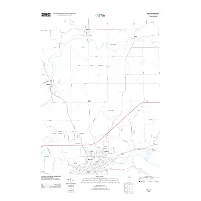
2013 Map of Peru
USGS Topo · Published 2013About this map
The Wabash River and Mississinewa River converge in the southern portion of this region, shaping the layout of settlements like Ridgeview and Oakdale. This drainage network, which also includes the Eel River and its northern tributaries like Weesau Cr and Washonis Cr, defines the local geography. The landscape is a mix of established towns and smaller hubs such as Mexico and Denver, connected by a dense grid of rural roads like N Meridian Rd and N Mexico Rd.
Find a feature on this map
143 named features on this map. Tap any name to fly to it.
Don’t see what you’re looking for? This feature index may not catch every label — zoom into the map to look around manually.
Map Details
Editions of this 2013 Peru Map
This is the sole edition of this map. No revisions or reprints were ever made.
Other maps of this area

1951 · Peru
USGS Topo · 1:24,000

1951 · Onward
USGS Topo · 1:24,000

1951 · Twelve Mile
USGS Topo · 1:24,000

1951 · Bunker Hill
USGS Topo · 1:24,000

1951 · Richvalley
USGS Topo · 1:24,000

1953 · Peoria
USGS Topo · 1:24,000

1953 · Danville
USGS Topo · 1:250,000

1953 · Muncie
USGS Topo · 1:250,000

1955 · Danville
USGS Topo · 1:250,000

1956 · Muncie
USGS Topo · 1:250,000