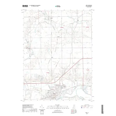
2019 Map of Peru
USGS Topo · Published 2019About this map
The confluence of the Wabash River and the Mississinewa River anchors the southern portion of this landscape, defining the layout of Peru. This 2019 survey captures a complex network of waterways and historical burial grounds that trace the settlement patterns of Miami County. North of the city, the Eel River winds through smaller communities like Mexico, Denver, and Chili. The map reveals a dense distribution of rural landmarks, including the Old German Baptist Cem and several other family or church graveyards such as Shrock Cem and Westlawn Cem.
Find a feature on this map
138 named features on this map. Tap any name to fly to it.
Don’t see what you’re looking for? This feature index may not catch every label — zoom into the map to look around manually.
Map Details
Editions of this 2019 Peru Map
This is the sole edition of this map. No revisions or reprints were ever made.
Other maps of this area

1951 · Peru
USGS Topo · 1:24,000

1951 · Onward
USGS Topo · 1:24,000

1951 · Twelve Mile
USGS Topo · 1:24,000

1951 · Bunker Hill
USGS Topo · 1:24,000

1951 · Richvalley
USGS Topo · 1:24,000

1953 · Peoria
USGS Topo · 1:24,000

1953 · Danville
USGS Topo · 1:250,000

1953 · Muncie
USGS Topo · 1:250,000

1955 · Danville
USGS Topo · 1:250,000

1956 · Muncie
USGS Topo · 1:250,000