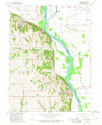
1966 Map of Peru
USGS Topo · Published 1968About this map
The Missouri River meanders through this mid-1960s survey, defining the border between Nebraska and Missouri as it winds past the bluff-side community of Peru. This landscape is dominated by the sprawling campus of Peru State College and the industrial passage of the Chicago Burlington and Quincy railroad. The map illustrates a transitional river environment, where the broad bottomlands of Evans Island contrast with the dissected hills of the Peru and Brownville precincts. Local history is deeply embedded in the rural infrastructure, from the Toll Bridge spanning the river to established social centers like Neal Park. The agricultural character of the era is evident in the network of creeks such as Buck Creek and Honey Creek, which fed into the river system before modern hydrological changes further altered the channel's course and its surrounding sloughs.
Find a feature on this map
26 named features on this map. Tap any name to fly to it.
Don’t see what you’re looking for? This feature index may not catch every label — zoom into the map to look around manually.
Map Details
Editions of this 1966 Peru Map
2 editions found
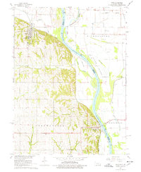
Other maps of this area

1907 · Nebraska City
USGS Topo · 1:62,500

1915 · Nemaha
USGS Topo · 1:62,500

1915 · Howe
USGS Topo · 1:62,500

1939 · Hamburg
USGS Topo · 1:62,500

1939 · Nemaha
USGS Topo · 1:62,500

1941 · Hamburg
USGS Topo · 1:62,500

1949 · Nemaha
USGS Topo · 1:62,500

1955 · Nebraska City
USGS Topo · 1:250,000

1957 · Nebraska City
USGS Topo · 1:250,000

1958 · Nebraska City
USGS Topo · 1:250,000