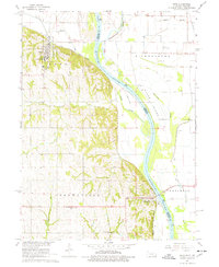
1966 Map of Peru
USGS Topo · Published 1978About this map
Peru stands prominently on the western bluffs above the Missouri River in this mid-1960s landscape, anchored by the campus of Peru State College. To the south, the village of Brownville serves as a gateway across the river via the Toll Bridge, connecting Nebraska to Missouri. The river valley itself is a complex network of shifting boundaries and watercourses, including the Nishnabotna River and Evans Island. The presence of the Chicago Burlington and Quincy railroad line, winding along the base of the loess hills, underscores the historical importance of the river corridor for transportation. Local history is well-preserved through numerous rural landmarks such as Locust Grove Sch, Mt Vernon Cem, and the tucked-away Happy Hollow Sch, illustrating the dispersed settlement patterns of Nemaha County during this era.
Find a feature on this map
32 named features on this map. Tap any name to fly to it.
Don’t see what you’re looking for? This feature index may not catch every label — zoom into the map to look around manually.
Map Details
Editions of this 1966 Peru Map
2 editions found
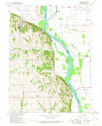
Other maps of this area

1907 · Nebraska City
USGS Topo · 1:62,500

1915 · Nemaha
USGS Topo · 1:62,500

1915 · Howe
USGS Topo · 1:62,500

1939 · Hamburg
USGS Topo · 1:62,500

1939 · Nemaha
USGS Topo · 1:62,500

1941 · Hamburg
USGS Topo · 1:62,500

1949 · Nemaha
USGS Topo · 1:62,500

1955 · Nebraska City
USGS Topo · 1:250,000

1957 · Nebraska City
USGS Topo · 1:250,000

1958 · Nebraska City
USGS Topo · 1:250,000