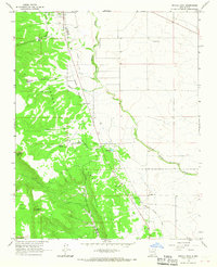
1963 Map of Petaca Peak
USGS Topo · Published 1967About this map
Carson National Forest dominates the western half of this landscape, where the high elevations of Petaca Peak and Petaca Mesa overlook the surrounding high desert. The terrain is defined by a series of deep drainages and canyons, including Dorado Canyon and Cañon de Tio Gordito. Along the eastern edge of the national forest boundary, an Old Railroad Grade runs north-to-south, tracing the county line between Taos and Rio Arriba.
Find a feature on this map
23 named features on this map. Tap any name to fly to it.
Don’t see what you’re looking for? This feature index may not catch every label — zoom into the map to look around manually.
Map Details
Editions of this 1963 Petaca Peak Map
This is the sole edition of this map. No revisions or reprints were ever made.
Other maps of this area

1918 · Abiquiu
USGS Topo · 1:125,000

1918 · Tusas
USGS Topo · 1:125,000

1953 · La Madera
USGS Topo · 1:24,000

1954 · Raton
USGS Topo · 1:250,000

1954 · Aztec
USGS Topo · 1:250,000

1958 · Raton
USGS Topo · 1:250,000

1958 · Aztec
USGS Topo · 1:250,000

1961 · Tres Orejas
USGS Topo · 1:24,000

1961 · Servilleta Plaza
USGS Topo · 1:24,000

1962 · Aztec
USGS Topo · 1:250,000