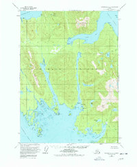
1953 Map of Petersburg A-2
USGS Topo · Published 1978About this map
Etolin Island dominates this mid-century maritime study, showcasing a wilderness of deep inlets and coastal peaks in the Tongass National Forest. The landscape is defined by its complex waterways, including Burnett Inlet, Mosman Inlet, and Mc Henry Inlet, which carve into the island's interior. Human presence is sparse, marked primarily by scattered cabins and coastal landmarks like Cannery Pt and Deadman Island. The interior is punctuated by prominent summits such as Alice Peak, Virginia Peak, and Navy Peak. Freshwater resources are abundant, with several large bodies of water including Burnett Lake, Hatchery Lake, and Olive Lake feeding into the surrounding straits. This survey illustrates the intricate relationship between the Alexander Archipelago's steep topography and its glacial inlets, providing a clear view of the area's geography before significant modern development.
Find a feature on this map
48 named features on this map. Tap any name to fly to it.
Don’t see what you’re looking for? This feature index may not catch every label — zoom into the map to look around manually.
Map Details
Editions of this 1953 Petersburg A-2 Map
3 editions found

Other maps of this area

1948 · Petersburg A-1
USGS Topo · 1:63,360

1948 · Petersburg A-2
USGS Topo · 1:63,360

1948 · Petersburg B-2
USGS Topo · 1:63,360

1948 · Petersburg B-1
USGS Topo · 1:63,360

1948 · Petersburg B-3
USGS Topo · 1:63,360

1949 · Craig D-3
USGS Topo · 1:63,360

1949 · Craig D-2
USGS Topo · 1:63,360

1949 · Petersburg A-3
USGS Topo · 1:63,360

1949 · Craig D-1
USGS Topo · 1:63,360

1950 · Craig D-3
USGS Topo · 1:63,360