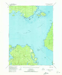
1949 Map of Petersburg B-4
USGS Topo · Published 1972About this map
Sumner Strait and Clarence Strait dominate this mid-century navigational corridor, serving as the aquatic arteries between major landmasses of the Alexander Archipelago. The survey illustrates the complex coastline of northern Prince of Wales Island, the southern reaches of Kupreanof Island, and the western edge of Zarembo Island. Because this area was documented via 1948 aerial photography and 1952 hydrographic charts, it preserves the vital maritime markers used by the fishing and logging fleets of the era, including The Eye Opener Light and the East Base (Astro Sta) triangulation point. The landscape is defined by its numerous small islands and bights, such as Level Islands and Sandy Bight, while inland features like Red Lake and Salmon Lake feed the coastal estuaries. This map captures the remote, uninhabited character of the Tongass National Forest before more modern infrastructure or intensive development reached these specific shorelines.
Find a feature on this map
44 named features on this map. Tap any name to fly to it.
Don’t see what you’re looking for? This feature index may not catch every label — zoom into the map to look around manually.
Map Details
Editions of this 1949 Petersburg B-4 Map
3 editions found
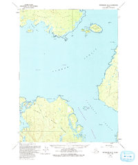
Other maps of this area

1948 · Petersburg C-4
USGS Topo · 1:63,360

1948 · Petersburg C-3
USGS Topo · 1:63,360

1948 · Petersburg C-5
USGS Topo · 1:63,360

1948 · Petersburg B-3
USGS Topo · 1:63,360

1949 · Petersburg B-5
USGS Topo · 1:63,360

1949 · Petersburg A-3
USGS Topo · 1:63,360

1949 · Petersburg A-5
USGS Topo · 1:63,360

1949 · Petersburg A-4
USGS Topo · 1:63,360

1949 · Petersburg B-4
USGS Topo · 1:63,360

1951 · Petersburg B-4
USGS Topo · 1:63,360