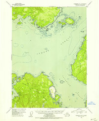
1951 Map of Petersburg B-4
USGS Topo · Published 1954About this map
The maritime crossroads of Southeast Alaska’s Alexander Archipelago are meticulously charted here, centering on the meeting of Sumner Strait and Clarence Strait. Surveyed just after the war, the map reveals a landscape dominated by the northern shores of Prince of Wales Island and the rugged coastlines of Kupreanof Island and Zarembo Island. Navigational aids essential for the regional fishing and timber trade are prominent, including The Eye Opener Light and Vichnefski Rock Light, which guide vessels through narrow channels and past hazards like Mc Arthur Reef.
Find a feature on this map
45 named features on this map. Tap any name to fly to it.
Don’t see what you’re looking for? This feature index may not catch every label — zoom into the map to look around manually.
Map Details
Editions of this 1951 Petersburg B-4 Map
2 editions found
Other maps of this area

1948 · Petersburg C-4
USGS Topo · 1:63,360

1948 · Petersburg C-3
USGS Topo · 1:63,360

1948 · Petersburg C-5
USGS Topo · 1:63,360

1948 · Petersburg B-3
USGS Topo · 1:63,360

1949 · Petersburg B-5
USGS Topo · 1:63,360

1949 · Petersburg A-3
USGS Topo · 1:63,360

1949 · Petersburg A-5
USGS Topo · 1:63,360

1949 · Petersburg A-4
USGS Topo · 1:63,360

1949 · Petersburg B-4
USGS Topo · 1:63,360

1951 · Petersburg B-4
USGS Topo · 1:63,360