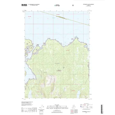
2017 Map of Petersburg B-4 SW
USGS Topo · Published 2017About this map
The northern reaches of Prince of Wales Island meet the Gulf of Alaska in this detailed study of the Alexander Archipelago. Dominated by the Tongass National Forest, the landscape is defined by its complex shoreline of bights and bays, including California Bay and Sandy Bight. Inland, the terrain rises toward Spruce Dome Hill, while a network of forest roads and trails, such as the Red Bay Lake Trail, provides access through the timber. Significant freshwater bodies like Salmon Bay Lake and Red Lake feed into the surrounding saltwater through outlets like Salmon Outlet. This area, split by the boundary between Petersburg Borough and the Prince of Wales-Hyder Census Area, showcases a wilderness environment where resource management and maritime navigation are primary features.
Find a feature on this map
42 named features on this map. Tap any name to fly to it.
Don’t see what you’re looking for? This feature index may not catch every label — zoom into the map to look around manually.
Map Details
Editions of this 2017 Petersburg B-4 SW Map
This is the sole edition of this map. No revisions or reprints were ever made.
Other maps of this area

1949 · Petersburg B-5
USGS Topo · 1:63,360

1949 · Petersburg A-5
USGS Topo · 1:63,360

1949 · Petersburg A-4
USGS Topo · 1:63,360

1949 · Petersburg B-4
USGS Topo · 1:63,360

1951 · Petersburg B-4
USGS Topo · 1:63,360

1952 · Petersburg
USGS Topo · 1:250,000
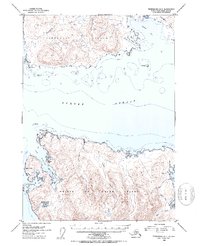
1953 · Petersburg B-5
USGS Topo · 1:63,360

1953 · Petersburg A-5
USGS Topo · 1:63,360

1953 · Petersburg A-4
USGS Topo · 1:63,360

1960 · Petersburg
USGS Topo · 1:250,000