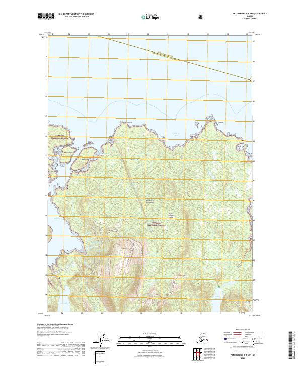
2021 Map of Petersburg B-4 SW
USGS Topo · Published 2021About this map
The Alexander Archipelago coastline dominates this 2021 study of the northern reaches of Prince of Wales Island. This coastal landscape is defined by its deep inlets and numerous offshore landforms, including Point Colpoys, Bell Island, and the rocky Danger Island. Within the interior, the Tongass National Forest covers the terrain, marked by a network of forest trails such as the Salmon Bay Lake Trl and Red Bay Lake Trl. Significant freshwater bodies like Red Lake and Salmon Bay Lake are connected to the coast via several numbered creeks, including Cr Number Two and Cr Number Three, illustrating the complex drainage patterns of this temperate rainforest environment. The presence of the North Prince of Wales Road and various service trails like the Pine Point 2079000 Rd Trl provides a detailed view of modern access to these remote coastal points and timber resources.
Find a feature on this map
41 named features on this map. Tap any name to fly to it.
Don’t see what you’re looking for? This feature index may not catch every label — zoom into the map to look around manually.
Map Details
Editions of this 2021 Petersburg B-4 SW Map
This is the sole edition of this map. No revisions or reprints were ever made.
Other maps of this area

1949 · Petersburg B-5
USGS Topo · 1:63,360

1949 · Petersburg A-5
USGS Topo · 1:63,360

1949 · Petersburg A-4
USGS Topo · 1:63,360

1949 · Petersburg B-4
USGS Topo · 1:63,360

1951 · Petersburg B-4
USGS Topo · 1:63,360

1952 · Petersburg
USGS Topo · 1:250,000
1953 · Petersburg B-5
USGS Topo · 1:63,360

1953 · Petersburg A-5
USGS Topo · 1:63,360

1953 · Petersburg A-4
USGS Topo · 1:63,360

1960 · Petersburg
USGS Topo · 1:250,000