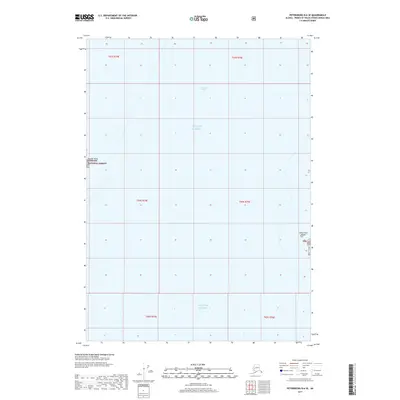
2017 Map of Petersburg B-6 SE
USGS Topo · Published 2017About this map
Sumner Strait and the open waters of the Gulf of Alaska dominate this 2017 maritime survey of the Alaska coastline. The map focuses on the shoreline within the Tongass National Forest, specifically highlighting Boulder Point and the isolated Labouchere Island. This particular quadrangle is primarily an aquatic study, illustrating the complex coastal boundaries where the national forest meets the sea. The inclusion of precise Public Land Survey System grids, such as t63s r74e and t64s r75e, provides essential reference points for researchers tracking land allotments and maritime boundaries in this remote coastal region of the Prince of Wales-Hyder Census Area.
Find a feature on this map
12 named features on this map. Tap any name to fly to it.
Don’t see what you’re looking for? This feature index may not catch every label — zoom into the map to look around manually.
Map Details
Editions of this 2017 Petersburg B-6 SE Map
This is the sole edition of this map. No revisions or reprints were ever made.
Other maps of this area

1948 · Petersburg A-6
USGS Topo · 1:63,360

1948 · Petersburg B-6
USGS Topo · 1:63,360

1949 · Petersburg B-5
USGS Topo · 1:63,360

1949 · Petersburg A-5
USGS Topo · 1:63,360

1951 · Petersburg B-6
USGS Topo · 1:63,360

1951 · Petersburg A-6
USGS Topo · 1:63,360

1952 · Petersburg
USGS Topo · 1:250,000
1953 · Petersburg B-5
USGS Topo · 1:63,360

1953 · Petersburg A-5
USGS Topo · 1:63,360

1960 · Petersburg
USGS Topo · 1:250,000