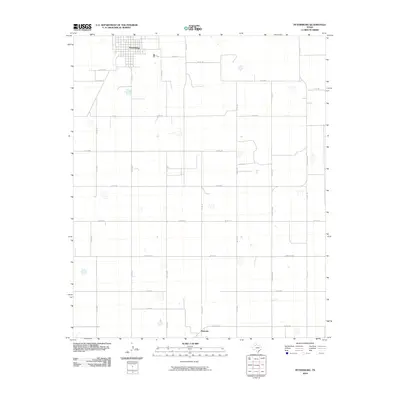
2010 Map of Petersburg
USGS Topo · Published 2010About this map
The town of Petersburg anchors the northern reaches of this High Plains landscape, its grid defined by local landmarks like Reed Ave and Alaska St. To the south, the settlement of Estacado sits at the junction of Ranch Rd 1527 and Co Rd 101, representing an area with deep roots in West Texas history. This 2010 survey illustrates a highly structured agricultural environment, where the land is partitioned by a dense network of farm-to-market and county roads such as Fm 789 and Co Rd 330. The terrain is characterized by numerous small, seasonally dry lake beds or depressions scattered across the plains, influencing the layout of the rural road system. Traces of historical movement are evident in named thoroughfares like Nazareth St, reflecting the persistent patterns of rural settlement and transport in Hale County.
Find a feature on this map
40 named features on this map. Tap any name to fly to it.
Don’t see what you’re looking for? This feature index may not catch every label — zoom into the map to look around manually.
Map Details
Editions of this 2010 Petersburg Map
This is the sole edition of this map. No revisions or reprints were ever made.
Other maps of this area

1954 · Lubbock
USGS Topo · 1:250,000

1965 · Idalou
USGS Topo · 1:24,000

1965 · Petersburg
USGS Topo · 1:24,000

1965 · Lorenzo
USGS Topo · 1:24,000

1965 · Heckville
USGS Topo · 1:24,000

1965 · Cone
USGS Topo · 1:24,000

1965 · Sandhill
USGS Topo · 1:24,000

1967 · Ralls
USGS Topo · 1:24,000

1968 · Barwise
USGS Topo · 1:24,000

1968 · Julia Lake
USGS Topo · 1:24,000