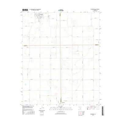
2016 Map of Petersburg
USGS Topo · Published 2016About this map
The town of Petersburg serves as the primary hub of this High Plains landscape, where the street grid transitions into a vast network of section roads. The map illustrates a strictly organized agricultural geography defined by the intersection of Hale, Floyd, Lubbock, and Crosby counties. Local history and genealogy interest centers on the Petersburg Cem located just east of the main town site, and the settlement of Estacado situated along the southern boundary near the Lubbock-Crosby county line. The terrain is characterized by numerous small depressions and playas typical of the Llano Estacado, linked by a systematic road network including Co Rd 5000 and Co Rd 110. This 2016 survey provides a contemporary view of the region's rural structure and the persistent boundaries of its early 20th-century townships.
Find a feature on this map
70 named features on this map. Tap any name to fly to it.
Don’t see what you’re looking for? This feature index may not catch every label — zoom into the map to look around manually.
Map Details
Editions of this 2016 Petersburg Map
This is the sole edition of this map. No revisions or reprints were ever made.
Other maps of this area

1954 · Lubbock
USGS Topo · 1:250,000

1965 · Idalou
USGS Topo · 1:24,000

1965 · Petersburg
USGS Topo · 1:24,000

1965 · Lorenzo
USGS Topo · 1:24,000

1965 · Heckville
USGS Topo · 1:24,000

1965 · Cone
USGS Topo · 1:24,000

1965 · Sandhill
USGS Topo · 1:24,000

1967 · Ralls
USGS Topo · 1:24,000

1968 · Barwise
USGS Topo · 1:24,000

1968 · Julia Lake
USGS Topo · 1:24,000