
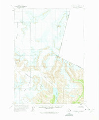
1961 Map of Petersburg D-1
USGS Topo · Published 1966About this map
Tongass National Forest dominates this Alaskan landscape, where massive ice fields and moving glaciers define the terrain at the edge of the international border. The survey documents the expansive reach of the Le Conte Glacier in the northwest and the Shakes Glacier toward the south, which feeds into the prominent Shakes Lake. These glacial systems are interspersed with significant peaks including Mount Pratt and Castle Mountain, illustrating the high-elevation relief of the Coast Mountains. The map specifically delineates the political boundary between the United States and Canada, marked by Boundary Peak 69. This 1960s-era data, compiled from aerial photography, captures the intricate relationship between the high Summit ice fields and the Popof Glacier before modern decades of glacial recession began to significantly alter these landmarks.
Find a feature on this map
12 named features on this map. Tap any name to fly to it.
Don’t see what you’re looking for? This feature index may not catch every label — zoom into the map to look around manually.
Map Details
Editions of this 1961 Petersburg D-1 Map
3 editions found
Other maps of this area

1948 · Petersburg C-1
USGS Topo · 1:63,360

1948 · Petersburg C-2
USGS Topo · 1:63,360

1951 · Bradfield Canal
USGS Topo · 1:250,000

1951 · Petersburg C-2
USGS Topo · 1:63,360

1952 · Petersburg
USGS Topo · 1:250,000

1952 · Sumdum
USGS Topo · 1:250,000

1953 · Petersburg C-1
USGS Topo · 1:63,360

1954 · Bradfield Canal
USGS Topo · 1:250,000

1955 · Bradfield canal D-6
USGS Topo · 1:63,360

1955 · Bradfield canal C-6
USGS Topo · 1:63,360