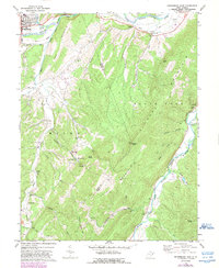
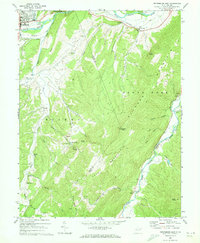
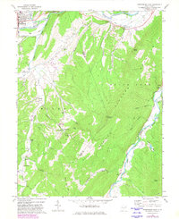
1969 Map of Petersburg East
USGS Topo · Published 1989About this map
The South Branch Potomac River and the South Fork Potomac River converge near the town of Petersburg, creating a landscape defined by deep valleys and high ridges. This late 1960s survey documents a community tied to the land, with numerous country churches such as Bakers Chapel, Sites Chapel, and St Matthews Ch dotting the valley floors. Local family heritage is preserved through markers like the Johnson Grave and the curiously named Boot Hill Ch.
Find a feature on this map
49 named features on this map. Tap any name to fly to it.
Don’t see what you’re looking for? This feature index may not catch every label — zoom into the map to look around manually.
Map Details
Editions of this 1969 Petersburg East Map
3 editions found
Other maps of this area

1891 · Romney
USGS Topo · 1:125,000

1892 · Franklin
USGS Topo · 1:125,000

1892 · Woodstock
USGS Topo · 1:125,000

1895 · Piedmont
USGS Topo · 1:125,000

1896 · Franklin
USGS Topo · 1:125,000

1920 · Petersburg
USGS Topo · 1:48,000

1920 · Moorefield
USGS Topo · 1:62,500

1921 · Orkney Springs
USGS Topo · 1:48,000

1921 · Petersburg
USGS Topo · 1:48,000

1921 · Greenland Gap
USGS Topo · 1:62,500