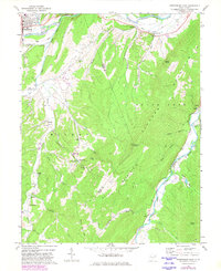
1969 Map of Petersburg East
USGS Topo · Published 1982About this map
Petersburg anchors the northwest corner of this West Virginia landscape, where the South Branch Potomac River cuts through the dramatic Petersburg Gap. The terrain is defined by massive ridges, including Mill Creek Mountain and Elkhorn Mountain, which frame the agricultural and residential life of the Milroy Valley. This region is dotted with local landmarks of genealogical importance, such as the Johnson Grave and several country churches like St Matthews Ch and Hedrick Chapel. South of the river, the Spring Run Fish Hatchery stands as a notable center of local conservation. The map also traces the Grant Co / Hardy Co boundary as it climbs over the heights of Getz Mountain, reflecting the area's rural development and land-use patterns in the late 1960s.
Find a feature on this map
44 named features on this map. Tap any name to fly to it.
Don’t see what you’re looking for? This feature index may not catch every label — zoom into the map to look around manually.
Map Details
Editions of this 1969 Petersburg East Map
3 editions found
Other maps of this area

1891 · Romney
USGS Topo · 1:125,000

1892 · Franklin
USGS Topo · 1:125,000

1892 · Woodstock
USGS Topo · 1:125,000

1895 · Piedmont
USGS Topo · 1:125,000

1896 · Franklin
USGS Topo · 1:125,000

1920 · Petersburg
USGS Topo · 1:48,000

1920 · Moorefield
USGS Topo · 1:62,500

1921 · Orkney Springs
USGS Topo · 1:48,000

1921 · Petersburg
USGS Topo · 1:48,000

1921 · Greenland Gap
USGS Topo · 1:62,500