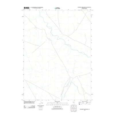
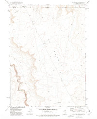
2012 Map of Peterson Table West
USGS Topo · Published 2012About this map
The South Fork Owyhee River meanders through this remote Elko County landscape, defining the local drainage system as it flows toward the northwest. This high-desert terrain is characterized by a sparse network of seasonal watercourses, including the north-flowing Fourmile Creek. The map documents a predominantly undeveloped area where the hydrological patterns of the Owyhee River watershed remain the primary landmarks. Historically, these river corridors have served as essential lifelines and navigational markers in the arid Great Basin, dictating the placement of early ranching routes and livestock movements. The survey provides a clear view of the natural topography and primitive road networks that cross this portion of the Peterson Table West quadrangle in the early 21st century.
Find a feature on this map
2 named features on this map. Tap any name to fly to it.
Don’t see what you’re looking for? This feature index may not catch every label — zoom into the map to look around manually.
Map Details
Editions of this 2012 Peterson Table West Map
This is the sole edition of this map. No revisions or reprints were ever made.
Other maps of this area

1955 · McDermitt
USGS Topo · 1:250,000

1959 · McDermitt
USGS Topo · 1:250,000

1964 · Hat Peak
USGS Topo · 1:62,500

1964 · Wilson Reservoir
USGS Topo · 1:62,500
1973 · Rubber Hill
USGS Topo · 1:24,000

1973 · Twelvemile Flat
USGS Topo · 1:24,000
1974 · Twelvemile Flat SE
USGS Topo · 1:24,000

1974 · Desert Ranch
USGS Topo · 1:24,000
1977 · Silver Lake
USGS Topo · 1:24,000
1977 · State Line Camp
USGS Topo · 1:24,000