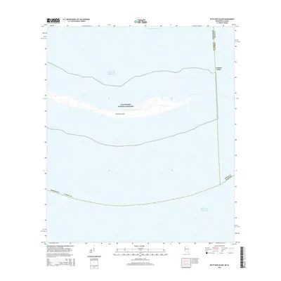
2015 Map of Petit Bois Island
USGS Topo · Published 2015About this map
Gulf Islands National Seashore centers this coastal survey, highlighting the shifting sands and delicate geography of Petit Bois Island. This narrow barrier island stretches across the waters of the Gulf of Mexico, serving as a critical boundary between the open sea and the more sheltered Intracoastal Waterway to the north. The map documents the precise state-line border where Mississippi meets Alabama, cutting through the eastern tip of the island and the waters near Dauphin Island. This 2015 edition provides a high-resolution view of the shoals, inlets, and sandbars that define the Mississippi Sound's outer reaches, documenting the ever-changing littoral environment before further tidal erosion or storm-driven modification occurs.
Find a feature on this map
8 named features on this map. Tap any name to fly to it.
Don’t see what you’re looking for? This feature index may not catch every label — zoom into the map to look around manually.
Map Details
Editions of this 2015 Petit Bois Island Map
This is the sole edition of this map. No revisions or reprints were ever made.
Other maps of this area

1921 · Grand Bay
USGS Topo · 1:62,500

1921 · Petit Bois Island
USGS Topo · 1:62,500

1941 · Horn Island
USGS Topo · 1:62,500

1942 · Petit Bois Island
USGS Topo · 1:62,500

1942 · Horn Island
USGS Topo · 1:62,500

1943 · Pascagoula
USGS Topo · 1:62,500

1943 · Grand Bay
USGS Topo · 1:62,500

1953 · Mobile
USGS Topo · 1:250,000

1955 · Pascagoula
USGS Topo · 1:62,500

1957 · Mobile
USGS Topo · 1:250,000