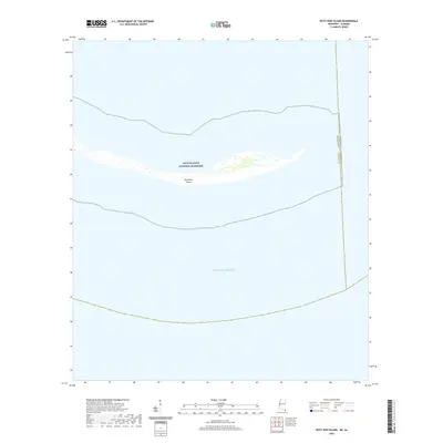
2020 Map of Petit Bois Island
USGS Topo · Published 2020About this map
Petit Bois Island stretches across the center of this maritime survey, a narrow barrier island situated within the protected waters of the Gulf Islands National Seashore. The map delineates the shifting coastal boundaries where the Mobile County and Jackson County line meets the state border between Alabama and Mississippi. This 2020 data captures the landform's isolated position in the open Gulf of Mexico, providing a modern baseline for researchers tracking coastal erosion and the preservation of these critical avian habitats. The absence of roads or permanent structures reflects the island's status as a wilderness area, where natural processes and tidal movements dictate the changing shoreline of the Mississippi Sound.
Find a feature on this map
5 named features on this map. Tap any name to fly to it.
Don’t see what you’re looking for? This feature index may not catch every label — zoom into the map to look around manually.
Map Details
Editions of this 2020 Petit Bois Island Map
This is the sole edition of this map. No revisions or reprints were ever made.
Other maps of this area

1921 · Grand Bay
USGS Topo · 1:62,500

1921 · Petit Bois Island
USGS Topo · 1:62,500

1941 · Horn Island
USGS Topo · 1:62,500

1942 · Petit Bois Island
USGS Topo · 1:62,500

1942 · Horn Island
USGS Topo · 1:62,500

1943 · Pascagoula
USGS Topo · 1:62,500

1943 · Grand Bay
USGS Topo · 1:62,500

1953 · Mobile
USGS Topo · 1:250,000

1955 · Pascagoula
USGS Topo · 1:62,500

1957 · Mobile
USGS Topo · 1:250,000