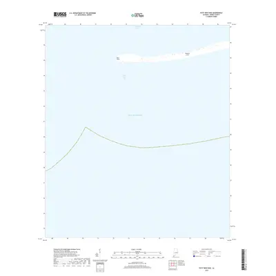
2018 Map of Petit Bois Pass
USGS Topo · Published 2018About this map
Dauphin Island stretches along the upper portion of this maritime survey, forming a critical barrier between the Mississippi Sound and the open Gulf of Mexico. The western extremity of the island is marked by West Point, a shifting sandy landform that helps define the eastern edge of Petit Bois Pass. This channel serves as a vital hydrological connection, allowing the exchange of waters between the sheltered sound and the gulf. The map illustrates the specialized topography of this coastal environment, where low-lying sandbars and seasonal shorelines are constantly reshaped by the tides and tropical weather systems common to the Mobile County coast. These features represent the westernmost reaches of the Alabama barrier island chain before the transition into Mississippi state waters.
Find a feature on this map
5 named features on this map. Tap any name to fly to it.
Don’t see what you’re looking for? This feature index may not catch every label — zoom into the map to look around manually.
Map Details
Editions of this 2018 Petit Bois Pass Map
This is the sole edition of this map. No revisions or reprints were ever made.
Other maps of this area

1921 · Grand Bay
USGS Topo · 1:62,500

1921 · Petit Bois Island
USGS Topo · 1:62,500

1921 · Dauphin Island
USGS Topo · 1:62,500

1921 · Delchamps
USGS Topo · 1:62,500

1941 · Cedar Point
USGS Topo · 1:62,500

1942 · Petit Bois Island
USGS Topo · 1:62,500

1942 · Fort Morgan
USGS Topo · 1:62,500

1943 · Cedar Point
USGS Topo · 1:62,500

1943 · Grand Bay
USGS Topo · 1:62,500

1953 · Mobile
USGS Topo · 1:250,000