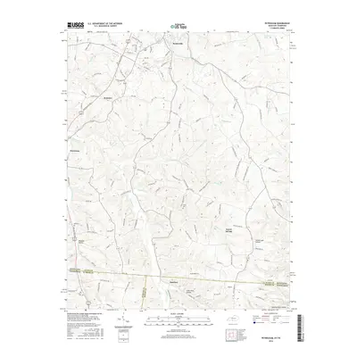
2016 Map of Petroleum
USGS Topo · Published 2016About this map
Scottsville anchors the northern reaches of this survey, where the rolling Kentucky landscape transitions into a network of deeply etched hollows and creek beds. The terrain is defined by the drainage of Trammel Cr and Rough Cr, creating a complex topography that dictated the placement of small rural communities like Petroleum and Rodemer. The southern portion of the map straddles the state line into Tennessee, where the remote settlement of Barefoot sits near the confluence of Florida Cr and Dry Br. This area is particularly rich for genealogical research, documenting several family-named landmarks and secluded burial sites such as Nancy Cem and the Old Carter Cem. The naming of Emma Cook Hollow and Wagoner Hollow further suggests a landscape deeply connected to its early inhabitants, while the presence of Steenbergen Spring highlights the importance of natural water sources in this border region.
Find a feature on this map
127 named features on this map. Tap any name to fly to it.
Don’t see what you’re looking for? This feature index may not catch every label — zoom into the map to look around manually.
Map Details
Editions of this 2016 Petroleum Map
This is the sole edition of this map. No revisions or reprints were ever made.
Other maps of this area

1921 · Bowling Green
USGS Topo · 1:62,500

1923 · Bowling Green
USGS Topo · 1:62,500

1926 · Scottsville
USGS Topo · 1:62,500

1928 · Adolphus
USGS Topo · 1:48,000

1931 · Lafayette
USGS Topo · 1:62,500

1931 · Adolphus
USGS Topo · 1:62,500

1942 · Gallatin
USGS Topo · 1:100,000

1954 · Austin
USGS Topo · 1:24,000

1954 · Petroleum
USGS Topo · 1:24,000

1954 · Scottsville
USGS Topo · 1:24,000