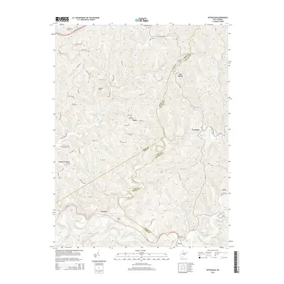
2014 Map of Petroleum
USGS Topo · Published 2014About this map
The Volcano Oil Field and the surrounding energy landscape of Oil Spring and Petroleum define this region of West Virginia. Situated at the junction of Wood, Ritchie, and Wirt counties, the terrain is marked by a dense network of ridges such as Cantwell Ridge and Progress Ridge, with the Hughes River flowing through the southern portion near Cisco. The map reveals a high concentration of small community burial grounds and fraternal organization sites, including the Independent Order of Odd Fellows Cem and Greenhill Catholic Cem near Eaton.
Find a feature on this map
94 named features on this map. Tap any name to fly to it.
Don’t see what you’re looking for? This feature index may not catch every label — zoom into the map to look around manually.
Map Details
Editions of this 2014 Petroleum Map
This is the sole edition of this map. No revisions or reprints were ever made.
Other maps of this area

1904 · Marietta
USGS Topo · 1:62,500

1906 · Saint Marys
USGS Topo · 1:62,500

1906 · Elizabeth
USGS Topo · 1:62,500

1907 · Harrisville
USGS Topo · 1:62,500

1924 · St Marys
USGS Topo · 1:62,500

1924 · Harrisville
USGS Topo · 1:62,500

1924 · Marietta
USGS Topo · 1:62,500

1924 · Elizabeth
USGS Topo · 1:62,500

1926 · Elizabeth
USGS Topo · 1:62,500

1926 · Harrisville
USGS Topo · 1:62,500