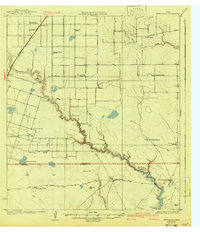
1924 Map of Petronilla
USGS Topo · Published 1941About this map
Large cattle ranches and a burgeoning agricultural infrastructure define the South Texas landscape between the Nueces and Kleberg County line. The ranching heritage is evident in expansive holdings such as the Los Laureles Ranch, Ratamosa Ranch, and Luby Ranch, while the shift toward cotton farming is marked by several gins, including Stockton Gin and Barbee Gin. The era's focus on rural education is remarkably dense here, with numerous local institutions like Petronilla School, Mexican School No 2, and Norwood School serving the dispersed ranching communities.
Find a feature on this map
40 named features on this map. Tap any name to fly to it.
Don’t see what you’re looking for? This feature index may not catch every label — zoom into the map to look around manually.
Map Details
Editions of this 1924 Petronilla Map
2 editions found
Other maps of this area

1924 · Petronilla
USGS Topo · 1:62,500

1925 · Robstown
USGS Topo · 1:62,500

1925 · Oso Creek
USGS Topo · 1:62,500

1925 · Corpus Christi
USGS Topo · 1:62,500

1928 · Sarita
USGS Topo · 1:125,000

1950 · Corpus Christi
USGS Topo · 1:250,000

1951 · Corpus Christi
USGS Topo · 1:24,000

1951 · Corpus Christi
USGS Topo · 1:62,500

1951 · South Bird Island NW
USGS Topo · 1:24,000

1951 · Oso Creek NW
USGS Topo · 1:24,000