
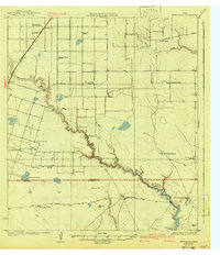
1924 Map of Petronilla
USGS Topo · Published 1924About this map
Petronilla Creek and Agua Dulce Creek meander through this coastal Texas landscape, defining the boundaries of expansive agricultural holdings and early educational centers. The mapping shows a transition from traditional ranching to industrial cotton production, evidenced by the distribution of Baldwin Gin, Barbee Gin, and Butts Gin. The presence of American School No 2 and Mexican School No 2 reflects the social stratification and community organization of the mid-1920s in Nueces County.
Find a feature on this map
39 named features on this map. Tap any name to fly to it.
Don’t see what you’re looking for? This feature index may not catch every label — zoom into the map to look around manually.
Map Details
Editions of this 1924 Petronilla Map
2 editions found
Other maps of this area

1925 · Robstown
USGS Topo · 1:62,500

1925 · Oso Creek
USGS Topo · 1:62,500

1925 · Corpus Christi
USGS Topo · 1:62,500

1928 · Sarita
USGS Topo · 1:125,000

1950 · Corpus Christi
USGS Topo · 1:250,000

1951 · Corpus Christi
USGS Topo · 1:24,000

1951 · Corpus Christi
USGS Topo · 1:62,500

1951 · South Bird Island NW
USGS Topo · 1:24,000

1951 · Oso Creek NW
USGS Topo · 1:24,000

1951 · Riviera Beach NE
USGS Topo · 1:24,000