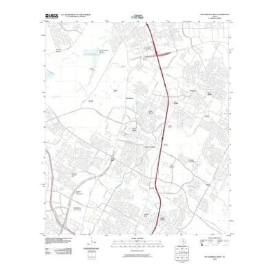
2010 Map of Pflugerville West
USGS Topo · Published 2010About this map
The Edward H Rogers Homestead and McNeil Cemetery anchor the historical landscape of this northern Travis County region, where old farming roots meet modern expansion. The map detail highlights the transition from traditional settlements like McNeil and Merrelltown to the denser residential developments of Wells Branch and Windemere. Significant institutional footprints are visible, including the University of Texas Balcones Research Center and the Austin Executive Airpark near Dessau. Waterways such as Walnut Creek, Rattan Creek, and Gilleland Creek cut through the developed areas, often managed by infrastructure like the Soil Conservation Service Site 9 Dam. The presence of established cemeteries, such as the Bratton Cemetery, alongside newer commercial hubs like La Frontera in Round Rock illustrates the rapid urbanization occurring during this period.
Find a feature on this map
83 named features on this map. Tap any name to fly to it.
Don’t see what you’re looking for? This feature index may not catch every label — zoom into the map to look around manually.
Map Details
Editions of this 2010 Pflugerville West Map
This is the sole edition of this map. No revisions or reprints were ever made.
Other maps of this area

1893 · Georgetown
USGS Topo · 1:125,000

1896 · Austin
USGS Topo · 1:125,000

1897 · Austin
USGS Topo · 1:125,000

1910 · Austin
USGS Topo · 1:125,000

1925 · Georgetown 4-d
USGS Topo · 1:48,000

1928 · Round Rock
USGS Topo · 1:62,500

1932 · Mt. Bonnell
USGS Topo · 1:62,500

1949 · Round Rock
USGS Topo · 1:62,500

1951 · Round Rock
USGS Topo · 1:62,500

1954 · Austin East
USGS Topo · 1:24,000