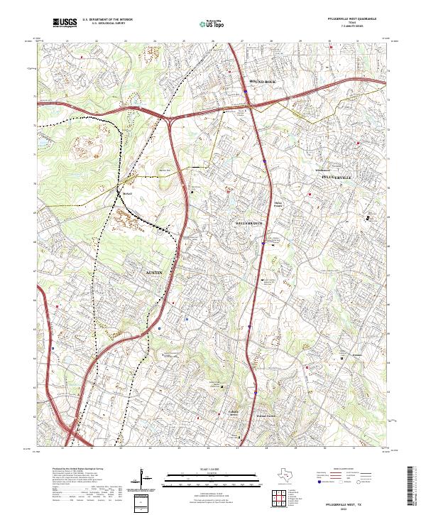
2022 Map of Pflugerville West
USGS Topo · Published 2022About this map
Austin's northern expansion meets the growing residential corridors of Round Rock and Pflugerville in this contemporary topographical study. The landscape is defined by its transition from agricultural heritage to suburban density, evidenced by the numerous cemeteries tucked between modern developments, such as the Merrilltown Cem and the expansive Cook - Walden Capital Parks Cem and Mausoleum. The drainage patterns of Walnut Creek and Gilleland Creek still dictate the local topography, even as major thoroughfares like W Louis Henna Blvd and FM 734 reshape the way people move across the Williamson and Travis county line. The map highlights the concentration of educational and spiritual hubs, including the Austin Community College - Northridge Campus and the historic Walnut Creek Baptist Church, which serve as anchors for communities like Wells Branch and Windemere.
Find a feature on this map
58 named features on this map. Tap any name to fly to it.
Don’t see what you’re looking for? This feature index may not catch every label — zoom into the map to look around manually.
Map Details
Editions of this 2022 Pflugerville West Map
This is the sole edition of this map. No revisions or reprints were ever made.
Other maps of this area

1893 · Georgetown
USGS Topo · 1:125,000

1896 · Austin
USGS Topo · 1:125,000

1897 · Austin
USGS Topo · 1:125,000

1910 · Austin
USGS Topo · 1:125,000

1925 · Georgetown 4-d
USGS Topo · 1:48,000

1928 · Round Rock
USGS Topo · 1:62,500

1932 · Mt. Bonnell
USGS Topo · 1:62,500

1949 · Round Rock
USGS Topo · 1:62,500

1951 · Round Rock
USGS Topo · 1:62,500

1954 · Austin East
USGS Topo · 1:24,000