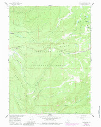
1961 Map of Phantom Lake
USGS Topo · Published 1984About this map
Medicine Bow National Forest encompasses this high-altitude landscape in Carbon County, where the topography is defined by the prominent Slash Ridge and Barrett Ridge. The area is a network of alpine hydrology, featuring a cluster of small lakes such as Phantom Lake, Magnolia Lake, and Arrastre Lake. The presence of Stamp Mill Lake and Gold Hill suggests the legacy of early mineral exploration and processing that often preceded forest management in the Wyoming high country. Centrally located, the Slash Ridge Lookout provides a glimpse into the forest fire detection infrastructure of the mid-20th century. The drainage patterns are complex, with the headwaters of North French Creek, Middle French Creek, and South French Creek carving through the timbered slopes. This 1961 survey, updated with 1980s data, documents a transition in public land use from resource extraction to managed recreation and conservation.
Find a feature on this map
20 named features on this map. Tap any name to fly to it.
Don’t see what you’re looking for? This feature index may not catch every label — zoom into the map to look around manually.
Map Details
Editions of this 1961 Phantom Lake Map
3 editions found
Other maps of this area

1906 · Medicine Bow
USGS Topo · 1:125,000

1908 · Medicine Bow
USGS Topo · 1:125,000

1939 · Saratoga
USGS Topo · 1:125,000

1954 · Rawlins
USGS Topo · 1:250,000

1958 · Rawlins
USGS Topo · 1:250,000

1961 · Overlook Hill
USGS Topo · 1:24,000

1961 · Ryan Park
USGS Topo · 1:24,000

1961 · Sand Lake
USGS Topo · 1:24,000
1961 · Kennaday Peak
USGS Topo · 1:24,000

1961 · Medicine Bow Peak
USGS Topo · 1:24,000