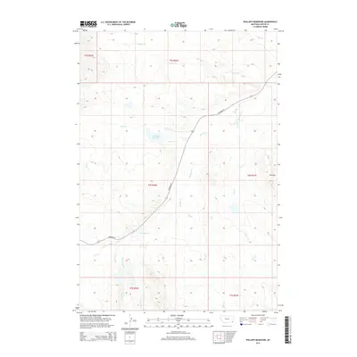
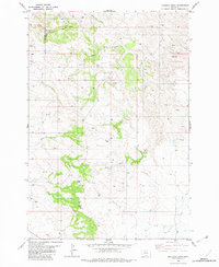
2014 Map of Phillippi Reservoir
USGS Topo · Published 2014About this map
Phillippi Reservoir serves as a central landmark in this remote corner of Carter County, Montana. The landscape is defined by its intricate drainage network, with several creek systems converging near the reservoir, including Soda Cr and N Soda Cr. The terrain is marked by the Flattops in the east, while drainage channels like Boxelder Cr, Park Cr, and Steep Cr carve through the southern sections. This area represents a classic example of high-plains water management and rangeland navigation, where access is provided by the winding path of Hammond Rd. Farther south, the smaller tributaries of Big Groat Cr and Little Groat Cr illustrate the complex watershed that supports the local ranching environment. This map captures the region's sparse settlement patterns and the vital importance of seasonal water sources in the northern plains.
Find a feature on this map
18 named features on this map. Tap any name to fly to it.
Don’t see what you’re looking for? This feature index may not catch every label — zoom into the map to look around manually.
Map Details
Editions of this 2014 Phillippi Reservoir Map
This is the sole edition of this map. No revisions or reprints were ever made.
Other maps of this area

1954 · Ekalaka
USGS Topo · 1:250,000

1956 · Ekalaka
USGS Topo · 1:250,000

1958 · Ekalaka
USGS Topo · 1:250,000

1965 · Ekalaka
USGS Topo · 1:250,000
1970 · Hammond
USGS Topo · 1:24,000
1970 · Greasy Hill
USGS Topo · 1:24,000

1981 · Alzada
USGS Topo · 1:100,000
1982 · Whitetail Creek
USGS Topo · 1:24,000

1982 · Phillippi Reservoir
USGS Topo · 1:24,000
1982 · Knudson Draw
USGS Topo · 1:24,000