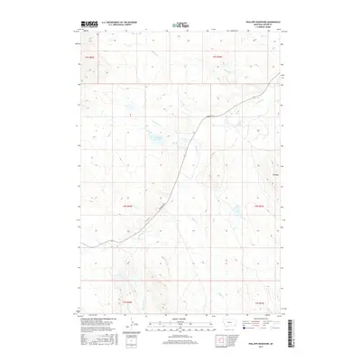
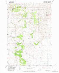
2017 Map of Phillippi Reservoir
USGS Topo · Published 2017About this map
Phillippi Reservoir serves as a central landmark in this high plains landscape of Carter County, where drainage systems define the movement of both water and travelers. The terrain is characterized by a network of intermittent streams, including Boxelder Cr, Soda Cr, and North Soda Creek, which cut through the undulating prairie. The primary overland route, Hammond Rd, snakes across the quadrangle, following the natural contours of the land and providing a modern connection through this ranching-focused corner of Montana.
Find a feature on this map
18 named features on this map. Tap any name to fly to it.
Don’t see what you’re looking for? This feature index may not catch every label — zoom into the map to look around manually.
Map Details
Editions of this 2017 Phillippi Reservoir Map
This is the sole edition of this map. No revisions or reprints were ever made.
Other maps of this area

1954 · Ekalaka
USGS Topo · 1:250,000

1956 · Ekalaka
USGS Topo · 1:250,000

1958 · Ekalaka
USGS Topo · 1:250,000

1965 · Ekalaka
USGS Topo · 1:250,000
1970 · Hammond
USGS Topo · 1:24,000
1970 · Greasy Hill
USGS Topo · 1:24,000

1981 · Alzada
USGS Topo · 1:100,000
1982 · Whitetail Creek
USGS Topo · 1:24,000

1982 · Phillippi Reservoir
USGS Topo · 1:24,000
1982 · Knudson Draw
USGS Topo · 1:24,000