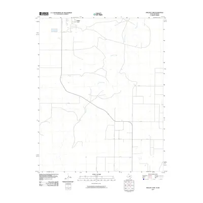
2010 Map of Phillips Camp
USGS Topo · Published 2010About this map
Phillips Camp stands as a primary point of interest in this High Plains landscape, situated near the northern edge of the Texas Panhandle. The area is defined by the winding course of Coldwater Creek, which carves through the terrain, providing a stark hydrological contrast to the surrounding agricultural grid. The map reveals a highly structured network of section roads, including Co Rd B, Co Rd C, and Co Rd E, which facilitate movement across this expansive ranching and farming region.
Find a feature on this map
12 named features on this map. Tap any name to fly to it.
Don’t see what you’re looking for? This feature index may not catch every label — zoom into the map to look around manually.
Map Details
Editions of this 2010 Phillips Camp Map
This is the sole edition of this map. No revisions or reprints were ever made.
Other maps of this area

1954 · Perryton
USGS Topo · 1:250,000

1958 · Perryton
USGS Topo · 1:250,000

1962 · Kimball
USGS Topo · 1:24,000

1968 · Guymon SW
USGS Topo · 1:24,000

1968 · Guymon SE
USGS Topo · 1:24,000

1973 · Goodwell SE
USGS Topo · 1:24,000

1973 · Gruver
USGS Topo · 1:24,000

1974 · Sunray 1 SE
USGS Topo · 1:24,000

1974 · Bernstein
USGS Topo · 1:24,000

1974 · Sunray 1 NE
USGS Topo · 1:24,000