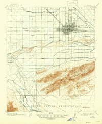
1914 Map of Phoenix
USGS Topo · Published 1946About this map
Phoenix is defined by a complex network of irrigation ditches and canals that drive the agricultural development of the Salt River valley. This 1912 survey, reprinted in 1946, shows the early urban grid of the city surrounded by foundational infrastructure like the Grand Canal, Salt River Valley Canal, and Western Canal. To the south, the Salt River Mountains provide a natural barrier above the Gila River Indian Reservation, where St Johns Chapel and Maricopa Village are established. Notable social landmarks of the era are recorded, including the Indian School, the State Hospital, and the County Poor Farm. Transportation is anchored by the Santa Fe Prescott and Phoenix RR, while isolated industrial sites like the Gold Coin Mine dot the southern foothills.
Find a feature on this map
41 named features on this map. Tap any name to fly to it.
Don’t see what you’re looking for? This feature index may not catch every label — zoom into the map to look around manually.
Map Details
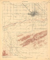
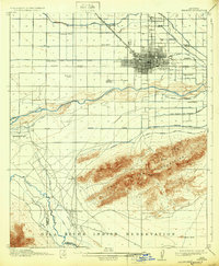
Editions of this 1914 Phoenix Map
4 editions found
Other maps of this area

1904 · Camelback
USGS Topo · 1:62,500

1906 · Camelsback
USGS Topo · 1:62,500

1912 · Phoenix
USGS Topo · 1:62,500

1913 · Mesa
USGS Topo · 1:62,500

1913 · Maricopa
USGS Topo · 1:62,500

1914 · Gila Butte
USGS Topo · 1:62,500

1914 · Phoenix
USGS Topo · 1:62,500

1915 · Mesa
USGS Topo · 1:62,500

1915 · Maricopa
USGS Topo · 1:62,500

1917 · Gila Butte
USGS Topo · 1:62,500