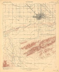
1914 Map of Phoenix
USGS Topo · Published 1914About this map
The growing agricultural hub of Phoenix is documented here just before World War I, centered within a complex lattice of irrigation canals essential to the desert economy. The landscape is defined by the engineered flow of the Grand Canal, Salt River Valley Canal, and the Wormer Canal, which supported a network of rural schools including Cartwright School and Isaac School. To the south, the massive Salt River Mountains rise above the basin, hiding the Gold Coin Mine and the route through Telegraph Pass.
Find a feature on this map
42 named features on this map. Tap any name to fly to it.
Don’t see what you’re looking for? This feature index may not catch every label — zoom into the map to look around manually.
Map Details
Editions of this 1914 Phoenix Map
4 editions found
Other maps of this area

1904 · Camelback
USGS Topo · 1:62,500

1906 · Camelsback
USGS Topo · 1:62,500

1912 · Phoenix
USGS Topo · 1:62,500

1913 · Mesa
USGS Topo · 1:62,500

1913 · Maricopa
USGS Topo · 1:62,500

1914 · Gila Butte
USGS Topo · 1:62,500

1914 · Phoenix
USGS Topo · 1:62,500

1915 · Mesa
USGS Topo · 1:62,500

1915 · Maricopa
USGS Topo · 1:62,500

1917 · Gila Butte
USGS Topo · 1:62,500