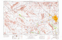
1954 Map of Phoenix
USGS Topo · Published 1974About this map
Phoenix sits at the center of an expanding agricultural and military landscape where the Salt River and Gila River converge. By the late 1960s, the development of planned communities like Sun City and Youngtown signaled a major shift in the Salt River Valley’s residential character. The presence of Luke Air Force Base and its various auxiliary fields, such as Luke AF No. 1, underscores the region’s importance as a strategic defense hub.
Find a feature on this map
77 named features on this map. Tap any name to fly to it.
Don’t see what you’re looking for? This feature index may not catch every label — zoom into the map to look around manually.
Map Details
Editions of this 1954 Phoenix Map
5 editions found

Other maps of this area

1887 · Verde
USGS Topo · 1:250,000

1887 · Prescott
USGS Topo · 1:250,000

1892 · Verde
USGS Topo · 1:250,000

1892 · Prescott
USGS Topo · 1:250,000

1903 · Bradshaw Mountains
USGS Topo · 1:125,000

1903 · Congress
USGS Topo · 1:125,000

1904 · Camelback
USGS Topo · 1:62,500

1904 · Congress
USGS Topo · 1:125,000

1906 · Camelsback
USGS Topo · 1:62,500

1911 · Parker
USGS Topo · 1:125,000