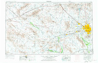
1954 Map of Phoenix
USGS Topo · Published 1976About this map
The Phoenix metropolitan area and the expansive Sonoran Desert landscape of Central Arizona are depicted here at a mid-century turning point. While the city of Phoenix and suburbs like Glendale and Sun City show the beginnings of rapid suburban expansion, the surrounding terrain remains dominated by desert plains and jagged massifs. The industrial legacy of the region is evident in the numerous operations dotting the mountains, including the legendary Vulture Gold Mine and the Silver Queen Mine.
Find a feature on this map
128 named features on this map. Tap any name to fly to it.
Don’t see what you’re looking for? This feature index may not catch every label — zoom into the map to look around manually.
Map Details
Editions of this 1954 Phoenix Map
5 editions found

Other maps of this area

1887 · Verde
USGS Topo · 1:250,000

1887 · Prescott
USGS Topo · 1:250,000

1892 · Verde
USGS Topo · 1:250,000

1892 · Prescott
USGS Topo · 1:250,000

1903 · Bradshaw Mountains
USGS Topo · 1:125,000

1903 · Congress
USGS Topo · 1:125,000

1904 · Camelback
USGS Topo · 1:62,500

1904 · Congress
USGS Topo · 1:125,000

1906 · Camelsback
USGS Topo · 1:62,500

1911 · Parker
USGS Topo · 1:125,000