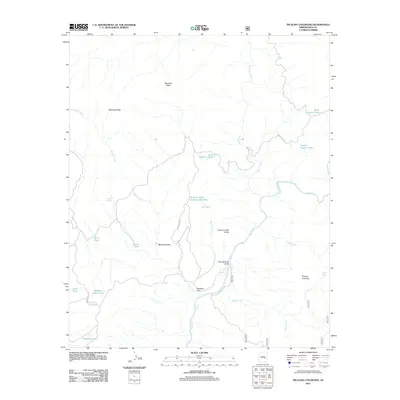
2011 Map of Picacho Colorado
USGS Topo · Published 2011About this map
Picacho Colorado and the neighboring settlement of Gleason Flat anchor this high-desert landscape in Gila County, where the Salt River carves a deep path through the terrain. The presence of the Gleason Flat Catchment and numerous livestock tanks, such as Medicine Butte Tank and Cypress Pasture Tank, reflects the essential water management required for ranching and land use in this arid region. Significant geographic features include the prominent Mustang Ridge to the northwest and the volcanic profiles of Medicine Butte and Canyon Creek Butte. This survey also documents the network of remote transportation routes, including Indian Rte 290 and Indian Rte 29, which connect these isolated outposts. Water sources like Albert Spring and Cedar Spring provide critical landmarks in a territory defined by deep draws and seasonal washes like Mud Springs Draw and Ash Creek.
Find a feature on this map
31 named features on this map. Tap any name to fly to it.
Don’t see what you’re looking for? This feature index may not catch every label — zoom into the map to look around manually.
Map Details
Editions of this 2011 Picacho Colorado Map
This is the sole edition of this map. No revisions or reprints were ever made.
Other maps of this area

1922 · Chrysotile
USGS Topo · 1:125,000

1946 · Blue House Mtn
USGS Topo · 1:62,500

1949 · McFadden Peak
USGS Topo · 1:62,500

1949 · Rockinstraw Mtn
USGS Topo · 1:62,500

1950 · Rockinstraw Mtn
USGS Topo · 1:62,500

1950 · McFadden Peak
USGS Topo · 1:62,500

1951 · Blue House Mtn
USGS Topo · 1:62,500

1954 · Mesa
USGS Topo · 1:250,000

1957 · Mesa
USGS Topo · 1:250,000

1958 · Mesa
USGS Topo · 1:250,000