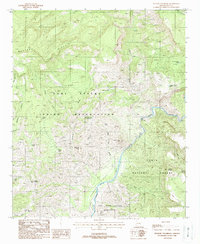
1988 Map of Picacho Colorado
USGS Topo · Published 1988About this map
The Fort Apache Indian Reservation and Tonto National Forest meet along a dramatic landscape defined by the deep carving of the Salt River. This late-1980s survey illustrates a rugged intersection of Gila County terrain where the river course is bounded by the Salt River Canyon Wilderness and high features like Mustang Ridge. Human activity is primarily centered on remote resource management and mining, indicated by scattered prospects and a Mine Shaft located north of Gleason Flat. The network of water management features, including Medicine Butte Tank No 2 and Quail Tank, reveals the vital infrastructure required for cattle or land management in this arid environment. Significant natural landmarks such as Picacho Colorado and the winding Canyon Creek dominate the topography, providing clear navigational markers for those studying the historical geography of this transition zone between tribal and forest lands.
Find a feature on this map
32 named features on this map. Tap any name to fly to it.
Don’t see what you’re looking for? This feature index may not catch every label — zoom into the map to look around manually.
Map Details
Editions of this 1988 Picacho Colorado Map
This is the sole edition of this map. No revisions or reprints were ever made.
Other maps of this area

1922 · Chrysotile
USGS Topo · 1:125,000

1946 · Blue House Mtn
USGS Topo · 1:62,500

1949 · McFadden Peak
USGS Topo · 1:62,500

1949 · Rockinstraw Mtn
USGS Topo · 1:62,500

1950 · Rockinstraw Mtn
USGS Topo · 1:62,500

1950 · McFadden Peak
USGS Topo · 1:62,500

1951 · Blue House Mtn
USGS Topo · 1:62,500

1954 · Mesa
USGS Topo · 1:250,000

1957 · Mesa
USGS Topo · 1:250,000

1958 · Mesa
USGS Topo · 1:250,000