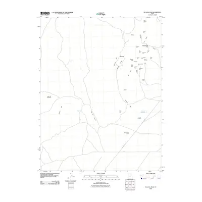
2010 Map of Picacho Peak
USGS Topo · Published 2010About this map
Shenandoah City and the surrounding high desert of the Star Range define this 2010 survey of Beaver County. The landscape is a complex network of mining claims, where the industrial legacy of the region is etched into the terrain through dozens of named operations. Notable sites include the Cedar Talisman Mine in the north and the Velvet Silver Mine to the south, highlighting a history of mineral extraction that shaped local settlement patterns.
Find a feature on this map
37 named features on this map. Tap any name to fly to it.
Don’t see what you’re looking for? This feature index may not catch every label — zoom into the map to look around manually.
Map Details
Editions of this 2010 Picacho Peak Map
This is the sole edition of this map. No revisions or reprints were ever made.
Other maps of this area

1953 · Ninemile Knoll
USGS Topo · 1:24,000

1953 · Milford Flat
USGS Topo · 1:24,000

1953 · Richfield
USGS Topo · 1:250,000

1958 · Richfield
USGS Topo · 1:250,000

1958 · Thermo
USGS Topo · 1:62,500

1958 · Milford
USGS Topo · 1:62,500

1958 · Milford
USGS Topo · 1:24,000

1959 · Frisco
USGS Topo · 1:62,500
1971 · Burns Knoll
USGS Topo · 1:24,000

1980 · Wah Wah Mts. South
USGS Topo · 1:100,000