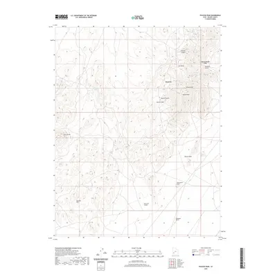
2020 Map of Picacho Peak
USGS Topo · Published 2020About this map
The Star Range defines the high ground of this Beaver County landscape, where the settlements of Shauntie and Shenandoah City sit among the mineral-rich canyons. The terrain transitions from the heights of Picacho Peak and Topache Peak down into the northern reaches of the Escalante Desert. Water is a critical and sparse resource here, marked by isolated points like Wheeler Spring and Windhouse Spring, along with the Moscow Reservoir located near Moscow Wash. The network of canyons, including Elephant Canyon, Mammoth Canyon, and Moscow Canyon, illustrates a complex drainage pattern that has historically influenced travel and settlement in this arid environment. The map provides a detailed view of the Shauntie Hills and the winding Shauntie Wash, offering a clear picture of the topography that shaped local mining and ranching interests in the western Utah desert.
Find a feature on this map
18 named features on this map. Tap any name to fly to it.
Don’t see what you’re looking for? This feature index may not catch every label — zoom into the map to look around manually.
Map Details
Editions of this 2020 Picacho Peak Map
This is the sole edition of this map. No revisions or reprints were ever made.
Other maps of this area

1953 · Ninemile Knoll
USGS Topo · 1:24,000

1953 · Milford Flat
USGS Topo · 1:24,000

1953 · Richfield
USGS Topo · 1:250,000

1958 · Richfield
USGS Topo · 1:250,000

1958 · Thermo
USGS Topo · 1:62,500

1958 · Milford
USGS Topo · 1:62,500

1958 · Milford
USGS Topo · 1:24,000

1959 · Frisco
USGS Topo · 1:62,500
1971 · Burns Knoll
USGS Topo · 1:24,000

1980 · Wah Wah Mts. South
USGS Topo · 1:100,000