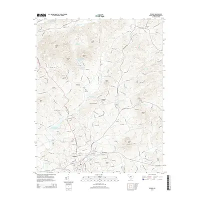
2014 Map of Pickens
USGS Topo · Published 2014About this map
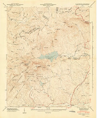
The Pickens city center and its northern rural surroundings are defined by a complex network of ridges and water management structures. To the north, the terrain rises toward Walnut Cove Mtn, Chapman Mtn, and Grassy Knob, while the Oolenoy River flows through the uppermost valley near the Oolenoy Valley Airport. The landscape is dotted with small-scale water bodies such as Finleys Lake and Dons Pond, along with larger projects like the Twelve Mile River Watershed Six Reservoir. These reservoirs and the Twelve Mile Watershed Structure highlight the mid-century regional focus on flood control and water conservation. For genealogists, the map is a dense resource of family history, naming several small burial grounds including Chastain Cem, Johnston Cem, and Porters Chapel Cem. Settlement patterns remain focused around historical crossroads like Midway and Pleasant View, connected by the prominent Moorefield Memorial Hwy.
Find a feature on this map
176 named features on this map. Tap any name to fly to it.
Don’t see what you’re looking for? This feature index may not catch every label — zoom into the map to look around manually.
Map Details
Editions of this 2014 Pickens Map
This is the sole edition of this map. No revisions or reprints were ever made.
Other maps of this area

1888 · Pickens
USGS Topo · 1:125,000

1894 · Pickens
USGS Topo · 1:125,000

1905 · Pisgah
USGS Topo · 1:125,000

1906 · Pisgah
USGS Topo · 1:125,000

1935 · Eastatoe Gap
USGS Topo · 1:24,000

1935 · Table Rock
USGS Topo · 1:24,000
1946 · Eastatoe Gap
USGS Topo · 1:24,000
1946 · Table Rock
USGS Topo · 1:24,000
1947 · Eastatoe Gap
USGS Topo · 1:24,000
1947 · Table Rock
USGS Topo · 1:24,000